
Brevard floods after rainy season ends
Heavy rains in early November brought historic totals to Central Florida while other regions face ongoing drought deficits.
By Zoe Harrison ·
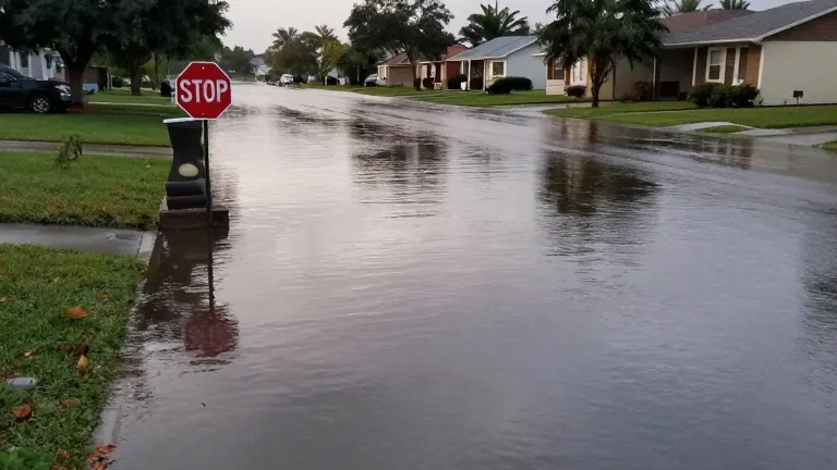
Flooding in southern Brevard County began receding on November 5, following days of historic rainfall that arrived after the climatological rainy season had already ended. The National Weather Service reported that persistent easterly winds and an upper-level disturbance drove repeated rounds of torrential rain starting November 1. Preliminary data from the Weather Prediction Center showed storm totals of 24.69 inches near Malabar and 22.75 inches near Grant-Valkaria. Melbourne Beach recorded 20.84 inches, while Melbourne International Airport logged approximately 13.70 inches. Officials warned that floodwaters along the St. Johns River could worsen as runoff continued to move through the basin.
The timing of the storm produced a sharp contrast with local climate averages. The Melbourne area received 25.75 inches of rain between June and September 2026, a figure below the 28.63 inch average for that period. The first four days of November delivered nearly half of that annual average for the rainy season. Titusville ended the June through September period with 38.83 inches of rain, exceeding its average of 29.4 inches.
Conditions varied widely across the rest of the state during the transition to the dry season. Central Florida finished the season with below normal rainfall. Orlando International Airport recorded only 2.57 inches of rain in September, leaving a deficit of 3.80 inches against a normal 6.37 inches. The National Weather Service in Melbourne identifies October 15 as the median start of the dry season for the region. Cooler temperatures and lower humidity arrived as fall cold fronts replaced daily summer thunderstorms.
West-Central Florida experienced a much wetter October. Sarasota-Bradenton recorded 9.76 inches of rain, making it the fifth-wettest October on record. Tampa received 5.47 inches, more than double its normal 2.34 inches. However, Fort Myers received only 1.21 inches, well below its normal 3.08 inches. The National Weather Service in Tampa Bay identifies October 10 as the typical end of the rainy season for that area.
North Florida and the Panhandle saw a rapid shift in weather patterns. Jacksonville recorded 11.23 inches of rain during the first 14 days of October, a surplus of 8.62 inches over normal. By October 19, average temperatures had dropped to 63 degrees, seven degrees below normal. Tallahassee received 6.71 inches of rain in the first 10 days of October, but the city remained 11.13 inches below normal for the year. No measurable rainfall fell in Tallahassee after October 27.
Statewide data from NOAA indicates that Florida received approximately 82% of normal September rainfall. Northern Florida received just 58% of its normal amount. As of September 29, about 52% of the state was experiencing some level of drought. The dry season will now rely on cold fronts and larger weather systems for precipitation rather than daily afternoon thunderstorms.